Early Season Nor'easter Set to Batter US East Coast With Rain and Wind
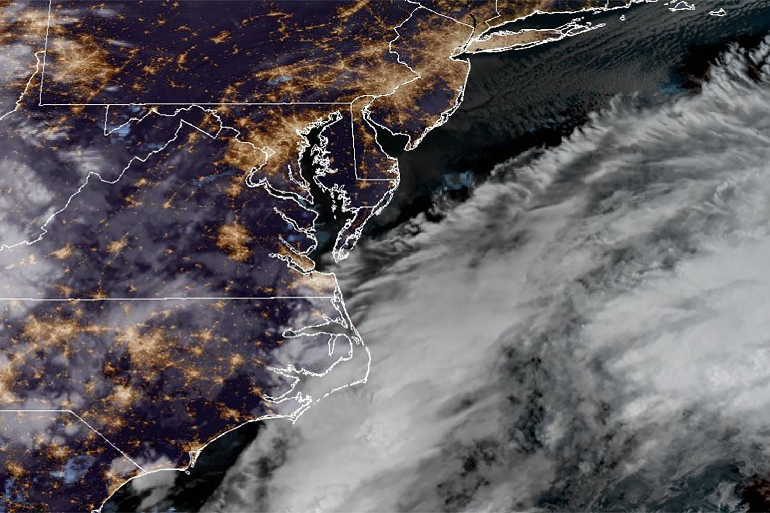
A rare September nor'easter is forming and could bring heavy rain, strong winds, and coastal flooding to the Northeast this weekend, with uncertainty around the storm's track and intensity.
By Marcus Bell · First published 24 Sept 2026
In brief
- A nor'easter is developing earlier than usual and is expected to impact the US East Coast this weekend.
- Meteorologists warn of heavy rain, strong winds, and possible flooding, especially in areas like Boston and Cape Cod.
- The storm's exact path remains uncertain, which could alter the severity of wind and rainfall in affected regions.
- Coastal communities are preparing for potential beach erosion and flooding due to higher-than-normal tides coinciding with the storm.
- Millions of people across the Northeast are on alert as forecasts become clearer but risks remain significant.
Timeline · 8 moments
First reports warn of early nor'easter forming in Atlantic
Fast Company ↗Meteorologists explain how nor'easters develop off the East Coast
ABCNews.com ↗September nor'easter's track and impact remain uncertain
The New York Times ↗Forecasts sharpen, Boston and Cape Cod at risk for worst impacts
The New York Times ↗NYC may dodge brunt as nor'easter targets Northeast
New York Post ↗Millions on alert as nor'easter approaches East Coast
ABC News ↗Waves already pounding beaches ahead of storm's arrival
CBS Top Stories ↗Rare September nor'easter expected to bring multi-day rain and wind
NBC News ↗How it started
Forecasters began tracking a developing storm system in the Atlantic earlier this week. Signs pointed to the early formation of a nor'easter, which is unusual for September. Typically, these storms are more common later in the fall and winter, but this one started taking shape between Georgia and New Jersey.
Meteorologists quickly noted the potential for heavy rain and strong winds. Early warnings were issued for regions along the East Coast, especially in the Northeast, as computer models hinted at a strengthening storm moving northward.
How it unfolded
On September 22, news outlets first reported that an early nor'easter could hit the East Coast toward the end of the week. The initial forecasts showed uncertainty about the storm's track, making it difficult to predict exactly where the worst impacts would be felt.
By September 23, more details emerged. Meteorologists warned that cities like Boston and Cape Cod could be among the hardest hit, with the possibility of 50 mph winds and heavy rainfall. New York City was expected to see wet and blustery conditions, but likely avoid the worst of the storm.
As the system developed, coastal areas began to feel the effects even before the weekend. High tides and pounding waves prompted concerns about flooding and beach erosion. Emergency preparations ramped up in vulnerable communities.
On September 24, the forecast became clearer. Millions of residents across the Northeast were placed on alert as the nor'easter continued to intensify. The combination of strong winds and heavy rain was expected to create hazardous conditions through at least Monday.
Where it stands
As of Thursday, the nor'easter is taking shape off the East Coast, with impacts already being felt in some coastal areas. Meteorologists say the storm will bring a multi-day period of rain, wind, and possible flooding, especially in New England.
The exact path remains uncertain, but the risk of flooding and beach erosion is significant due to the timing with higher-than-normal tides. Preparations are ongoing in cities and towns along the coast as residents brace for the weekend storm.
What to watch
The main questions are how far inland the storm's heaviest rain and winds will reach, and whether the track will shift closer to or farther from the coast. Residents should monitor official forecasts for updates, as changes in the storm's path could affect which areas are hit hardest. Emergency officials urge people in flood-prone and coastal areas to prepare for possible evacuations or disruptions.
More in Environment
All →
Hurricane Polo Weakens to Category 4 Off Mexico's Pacific Coast
Hurricane Polo has dropped to Category 4 strength but still poses serious threats to Mexico's coast and nearby regions.
20 sources · over 3 days
Super El Niño Projected to Cause 451,000 Heat Deaths Globally
Updated estimates show the ongoing Super El Niño may lead to 451,000 excess heat-related deaths worldwide by early 2027.
25 sources · over 4 days
Typhoon Dujuan Kills at Least Four, Leaves Thousands Without Power
Typhoon Dujuan has killed at least four people near Tokyo, caused severe flooding, and left thousands of homes without electricity.
26 sources · over 4 days