
Cyclone Murasu Begins Landfall on Andhra Coast as Evacuations Expand
Heavy rain and winds gusting to 120 kmph are hitting Andhra Pradesh as Cyclone Murasu begins landfall, with evacuations, school closures and transport disruption across affected states.
By Hushread Stories, from 14 outlets · First published 2 Nov 2026 · Chapter 2 of 2
Earlier: Cyclone Arnab Leaves Odisha Flooded as Murasu Approaches Andhra Pradesh
In brief
- Cyclone Murasu has begun making landfall on the Andhra Pradesh coast, bringing heavy rainfall and gale winds.
- The latest report puts sustained winds at up to 110 kmph, with gusts reaching 120 kmph.
- About 2,000 people had been evacuated from coastal areas, with officials planning to move around 30,000.
- Odisha separately reported evacuating 1.6 lakh people, with plans to move another 1.4 lakh to safety.
- Authorities are preparing for electricity damage while heavy rainfall threatens coastal Andhra Pradesh, Rayalaseema and parts of Odisha.

Timeline · 7 moments
Nineteen flights cancelled as Andhra Pradesh remains on alert
India Today ↗Odisha reports 1.6 lakh evacuated before expected landfall
Hindustan Times ↗Schools close across Andhra Pradesh, Tamil Nadu and Odisha
Swarajya ↗Severe cyclonic storm heads towards south Andhra coast
India Meteorological Department (IMD) - IMD YouTube ↗Naidu seeks neighbouring states' help for power restoration
Business Line - Home ↗Murasu moves northwestward as Andhra coast threat grows
Mint ↗Bay of Bengal low pressure system nears depression
India Meteorological Department (IMD) - IMD YouTube ↗How it started
Murasu developed over the Bay of Bengal just as eastern India was dealing with Cyclone Arnab's aftermath. On October 31, the India Meteorological Department reported a well marked low pressure area over the southeast Bay of Bengal and adjoining areas, with a depression likely within six hours.
The threat to Andhra Pradesh became clearer that day. The Hindu reported that the depression could become a severe cyclonic storm by November 2 and make landfall between Narsapur and Nellore on November 3, with maximum winds of 120 kmph.
How it unfolded
On November 1, Murasu was moving northwestward at about 25 kmph. At 5:30 pm, it was approximately 420 km from Chennai and 490 km from Nellore, according to Mint.
Preparations extended beyond evacuations. On November 1, Business Line reported that Andhra Pradesh Chief Minister Naidu sought support from Tamil Nadu and Karnataka, with additional workers and machinery being mobilised for electricity restoration.
By November 2, the India Meteorological Department described Murasu as a severe cyclonic storm over the west-central Bay of Bengal, forecast to cross the south Andhra Pradesh coast. Swarajya reported school closures across Andhra Pradesh, Tamil Nadu and Odisha.
Evacuations also expanded. Al Jazeera reported that about 2,000 people had been moved from coastal areas by Monday, with officials planning to evacuate around 30,000 as the storm approached Andhra Pradesh. Separately, Hindustan Times reported that Odisha had evacuated 1.6 lakh people and planned to move another 1.4 lakh.
Transport services were disrupted on November 2, with India Today reporting 19 flight cancellations. India News also reported train cancellations as authorities issued heavy rainfall warnings.
Where it stands
The latest report from NDTV India says Murasu began making landfall around 1 am on Tuesday, bringing heavy rain and winds of up to 110 kmph, gusting to 120 kmph. That is later in the sequence than the forecasts that still described landfall as pending.
There is a dating inconsistency in the supplied coverage: that report is indexed November 2 but describes landfall beginning on Tuesday, November 3. Its reported start time is also earlier than the 2-3 am forecast carried by News.
The risk extends inland and beyond the landfall area. Mint reported forecasts of heavy to extremely heavy rainfall and gale winds across parts of southern India over the next three days, with coastal Andhra Pradesh and Rayalaseema expected to bear the brunt.
What to watch
The immediate questions are how quickly evacuations can be completed and how much damage the winds cause to electricity supplies. Business Line reported that around 8,000 electricity poles across south coastal and Rayalaseema districts could be affected, although this was a risk estimate, not a confirmed damage count.
Rainfall remains a concern beyond Andhra Pradesh. Times now reported heavy rainfall warnings for five Odisha districts and advice for fishermen to stay off the sea. Further updates will be needed to establish the storm's completed landfall, inland track and actual damage.
More in Environment
All →
Supreme Court Allows Limited Diwali Crackers After Haryana Announces NCR Ban
Haryana announced a complete firecracker ban in its NCR districts, but a subsequent Supreme Court ruling permits certified green crackers across Delhi-NCR during fixed hours on November 7 and 8.
10 sources · over 4 days
Delhi Turns Back 1,539 Vehicles on First Day of Entry Ban
Delhi imposed Rs 68 lakh in fines as it enforced the pollution curbs on November 1.
13 sources · over 8 days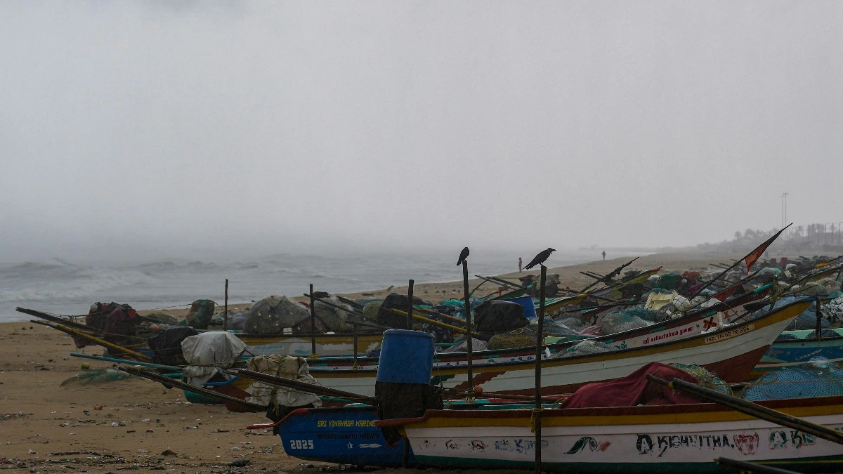
Cyclone Arnab Makes Landfall on Andhra Pradesh Coast
Cyclone Arnab made landfall with winds gusting up to 150 kmph, prompting evacuations and disruption across the region.
24 sources · over 8 days